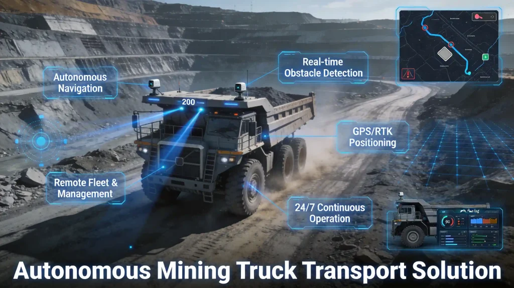
Mine Vehicle Anti-Collision and Blind Spot Monitoring System
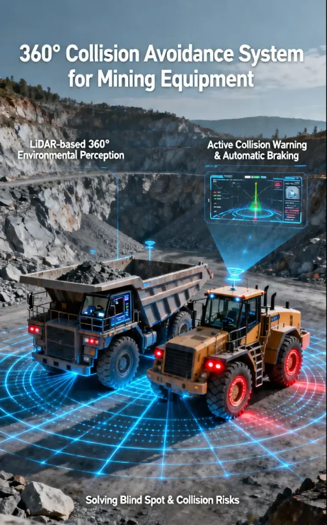
Solution Overview: Targeting the visual blind spots and collision risks of large mining equipment such as haul trucks and loaders, this system achieves 360° environmental perception through LiDAR, providing active anti-collision warning and automatic braking functions.
| Installation Position | Product Model | Detection Range | Functions |
| Front of Vehicle | Intrinsically Safe Explosion-Proof LiDAR | 150m forward | Forward anti-collision, AEB triggering |
| Rear / Sides of Vehicle | TM-16 | 360° × 150m | Blind spot monitoring, lane change assistance |
| Roof of Vehicle | TM128 Hybrid Solid-State LiDAR | 200m | Panoramic environmental perception |
Technical Highlights
Long-Distance Signal Transmission: Supports extension cables up to 15 meters with zero signal loss.
Intrinsically Safe & Explosion-Proof Certification: Tianmu Optoelectronics’ intrinsically safe LiDAR requires no additional flameproof enclosure, eliminating laser penetration loss. It features a compact form factor and excellent heat dissipation, and has obtained KA/MA certifications.
High Glare Resistance: Ensures stable operation under intense sunlight in Australia.
Extreme Environment Adaptability: Customized models support operation at -45℃, meeting the requirements of mining operations in high-altitude and cold regions.
LiDAR-Vision Fusion System
Integrating LiDAR and industrial cameras, this unit enables deep collaboration of multi-source data to capture spatial structure and image details simultaneously, delivering environment modeling with centimeter-level accuracy. Equipped with high-performance built-in AI algorithms, it supports multi-object detection (machinery, personnel, vehicles, etc.) and behavior recognition (crossing boundary, loitering, abnormal actions, etc.) to identify potential risks.
When the system detects safety hazards, it can automatically trigger audio & visual alarms or linkage control, greatly accelerating emergency response. It shifts from “passive response” to “active defense” and truly realizes closed-loop intelligent risk management.
The complete unit holds KA/MA intrinsic safety explosion-proof certification. Its core components adopt solid-state explosion-proof technology, allowing safe operation in flammable and explosive environments without an additional explosion-proof enclosure. It provides comprehensive and highly reliable perception solutions for hazardous sites such as mines, chemical plants, oil & gas facilities.
Automatic Laser Stocktaking System
In large-scale applications such as ore and sand & gravel industries, the system addresses challenges including vast sites, complex operating environments, and high-frequency data processing.
Through multi-point deployment, the distributed system enables real-time data acquisition, processing, and dynamic analysis, ensuring operational efficiency and accuracy over a wide area.
It supports a variety of stockyard types and scanning modes, enabling intelligent inventory across multiple regions and scenarios.
It features point cloud processing, volume calculation, 3D visualization, and report generation, meeting the requirements for efficient and precise silo & stockpile management.
Core Functions of the Backend System:3D Scanning and Modeling、Volume and Weight Calculation、Coal Stocktake Report Generation、Coal Yard Partition Management、Equipment Configuration and Monitoring、Historical Data Playback and Analysis、Installation Adaptability for Multiple Scenarios
In industrial automation and intelligent manufacturing, 3D scanning systems can obtain accurate 3D models of complex or hard-to-measure objects, providing basic data for reverse engineering.
In granary-like scenarios, 3D scanners can quickly and accurately measure the volume of grain piles and coal piles without manual intervention, greatly improving measurement efficiency and accuracy. They can also be used for grain quality monitoring and potential safety hazard inspection, ensuring the safety and stability of granaries.
In coal mine and similar applications, 3D scanners can monitor the deformation of coal mine roadways in real time and accurately measure the volume and surface area of coal piles. Combined with scanning data, they enable the overall stability assessment of coal mines, providing data support for early warning and prevention of coal mine disasters, as well as for safety management, resource management and optimal utilization.
Monorail Anti-Collision System
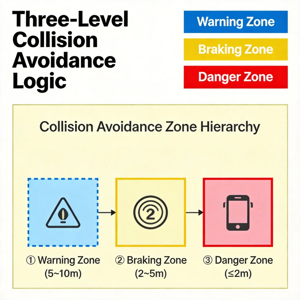
Monorail cranes are widely used in rail transportation scenarios in mines, tunnels, factories and other environments, mainly for material handling, equipment transportation and other tasks.
Industry Pain Points
Insufficient lighting, dust interference, and high risks of manual operation in underground mines.
Traditional Limitations
Low accuracy of mechanical limiters, unable to adapt to complex working conditions.
Safety Requirements
Intelligent anti-collision solutions are urgently needed for mining and tunnel scenarios.
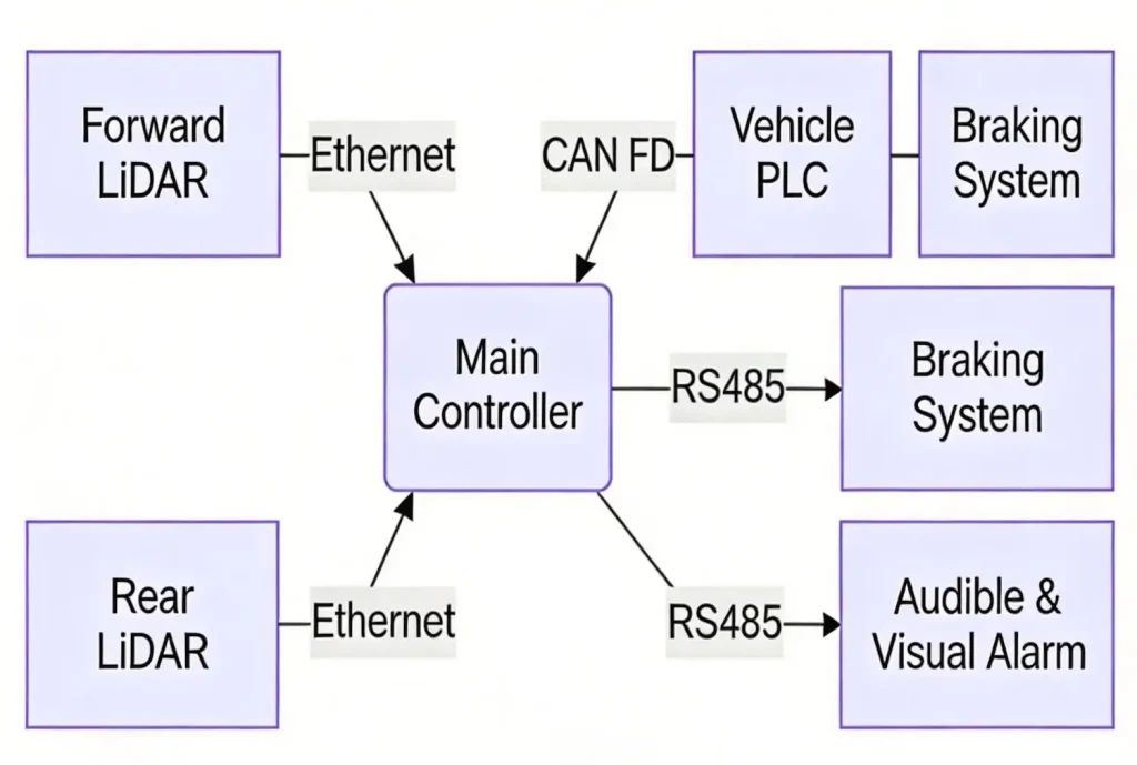
Sensor Configuration
| Parameter | Forward Radar | Rearward Radar |
| Model | GUJ120 | GUJ120 |
| Installation Position | Top of the front bracket | Top of the rear bracket |
| Scanning Angle | 270° horizontal + 30° pitch | 360° omnidirectional scanning |
| Detection Range | 0.5–30 m (forward) | 0.5–30 m (rearward) |
| Protection Rating | IP67 | IP67 |
Roadheader Pose Measurement System
Monorail cranes are widely used in rail transportation scenarios in mines, tunnels, factories and other environments, mainly for material handling and equipment transportation tasks.
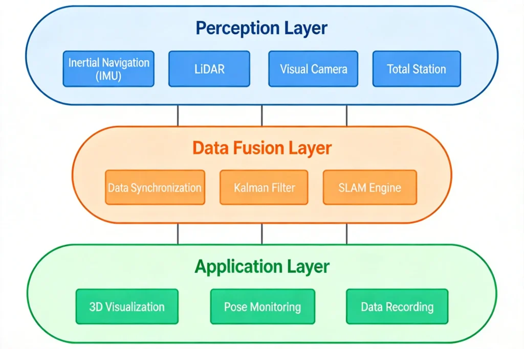
Advantages of the Roadheader Pose Measurement System
Real-time online display of point cloud scenes with a latency of no more than 200ms on the host computer.
Generates 3D point cloud maps of roadways.
Displays the 3D model of the vehicle within the point cloud.
Supports real-time display of the roadheader’s position and posture.
3D Scanning and Reconstruction System
It is mainly applied in industrial automation and intelligent manufacturing. For complex objects or those difficult to measure directly, a 3D scanning system can capture their accurate 3D models and provide basic data for reverse engineering.
In granary-like scenarios, 3D scanners can quickly and accurately measure the volume of grain piles and coal piles without manual intervention, greatly improving measurement efficiency and accuracy. They can also be used for grain quality monitoring and potential safety hazard inspection to ensure the safety and stability of granaries.
In application scenarios such as coal mines, 3D scanners can monitor the deformation of coal mine roadways in real time and accurately measure the volume and surface area of coal piles. Combined with scanning data, they enable the evaluation of the overall stability of coal mines, provide data support for early warning and prevention of coal mine disasters, and offer data support for safety management, resource management and optimized utilization.
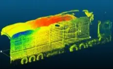
Handheld 3D Scanner
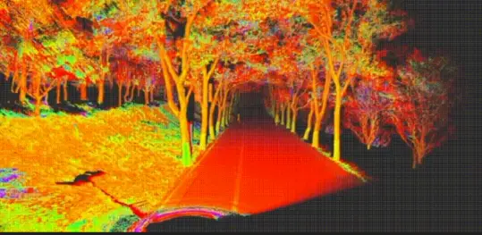
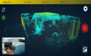
The handheld 3D scanner integrates LiDAR, inertial navigation and vision cameras, incorporating proprietary high-precision real-time 3D reconstruction algorithms, edge computing, deep learning, and multi-source data fusion technologies. Featuring high precision, high integration and high adaptability, it can be applied in a wide range of scenarios to empower various industries.
Compact body, lightweight handheld design, easy operation and flexible installation.
Compact body, lightweight handheld design, easy operation and flexible installation.
LiDAR + SLAM Algorithm, with self-developed point cloud processing software
Intelligent Computing System:Hybrid computing, ready for use upon export | Multiple computing methods ensure data accuracy | High protection, multi-platform compatible | Long-distance, high-frequency scanning
Controlled via mobile APP,:with real-time point cloud data preview | Replaces traditional touch screens | Multiple browsing and interaction modes | Rich human-computer interaction content
Professional post-processing software:with standardized processing workflows | Data browsing, optimization and format conversion | Multi-data registration and merging | Special application functions (volume measurement / mapping)

Laser Automated Material
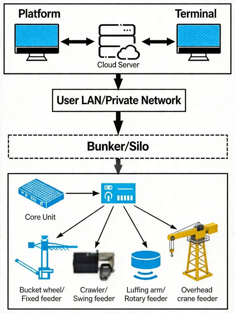
The Laser Automated Material Scanning Management System is an intelligent scanning solution based on advanced technologies such as artificial intelligence, omnidirectional LiDAR, and industrial IoT, specifically designed for industrial scenarios like material stockyards, mining sites, and power plants. The system enables high-precision 3D modeling, volume measurement, weight estimation, and intelligent early warning through distributed LiDAR real-time scanning, combined with edge computing and cloud data processing, helping enterprises achieve digital and automated material management.
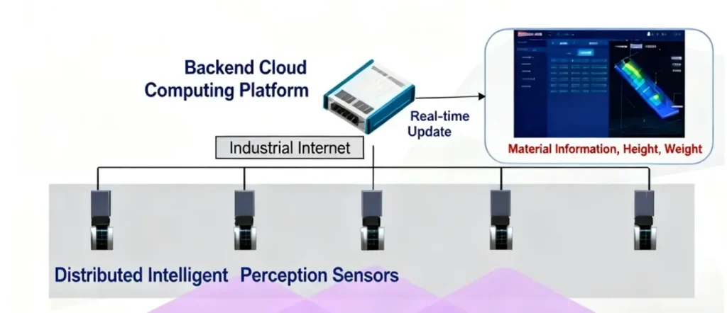
| Category | Feature | Description |
| Core Features | High-Speed Precision Scanning | Utilizes high-precision LiDAR with ±2cm accuracy and millisecond-level response for real-time data. Supports 360° horizontal and 270° vertical ultra-wide FOV scanning for large-scale material coverage. |
| Intelligent Data Fusion | Multi-device collaborative scanning with automatic data calibration and stitching (error <3cm). AI-optimized point cloud data enhances modeling accuracy. | |
| Real-Time Data Integration | Real-time cloud upload for visualized analytics, enabling volume measurement (accuracy <0.5%) and weight estimation (accuracy <1%). Seamlessly integrates with existing MES/ERP systems. | |
| Industrial-Grade Reliability | IP65 protection for harsh environments (dust, moisture). Operates at -20°C~60°C for extreme-condition stability. | |
| Multi-Scenario Deployment | Supports fixed installation (e.g., warehouse ceilings) or mobile deployment (e.g., cranes, AGVs). | |
| Smart Safety Alerts | Automatically detects pile height/slope to warn of collapse or overflow risks. | |
| Application Scenarios | Coal/Ore Stockyards:Real-time inventory monitoring and optimized logistics. Aggregate/Building Material Warehouses:Accurate stock calculation to reduce waste. Power Plants/Chemical Facilities: Prevent pile collapses and enhance safety Metal Ore Storage: Automated inventory for operational efficiency | |
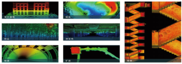
Application Scenarios for Smart Mines
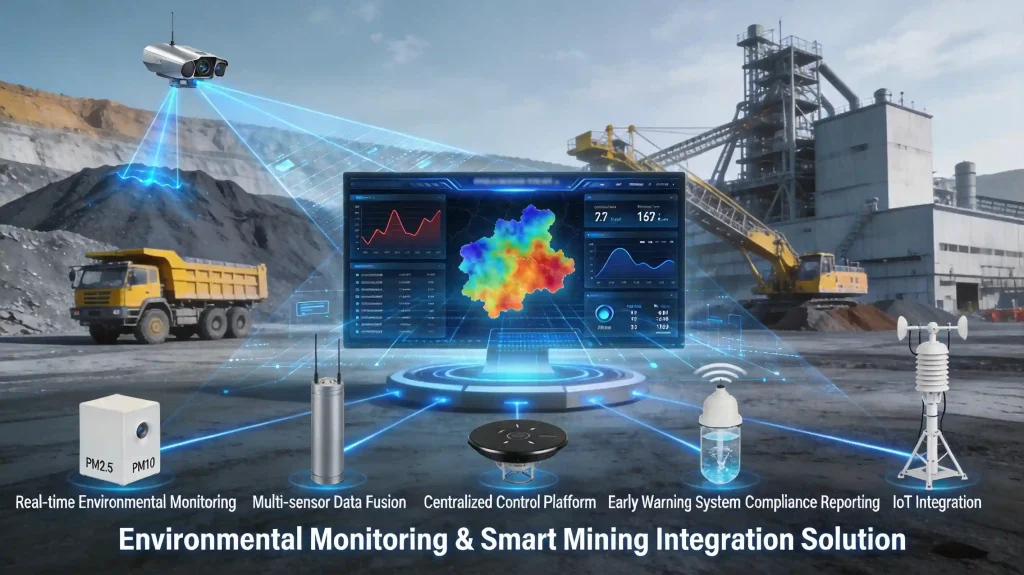
Environmental Monitoring
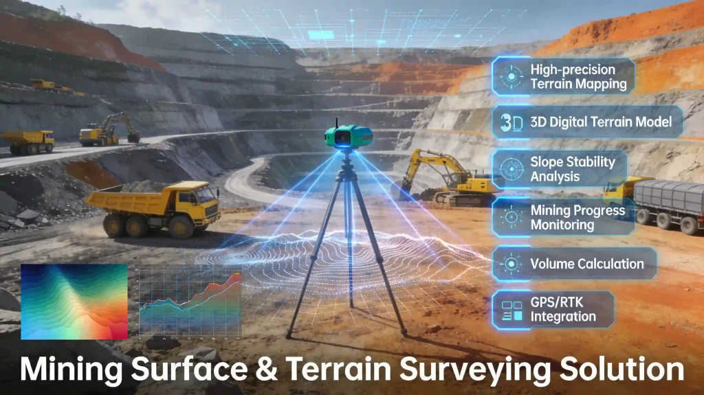
Topographic Survey
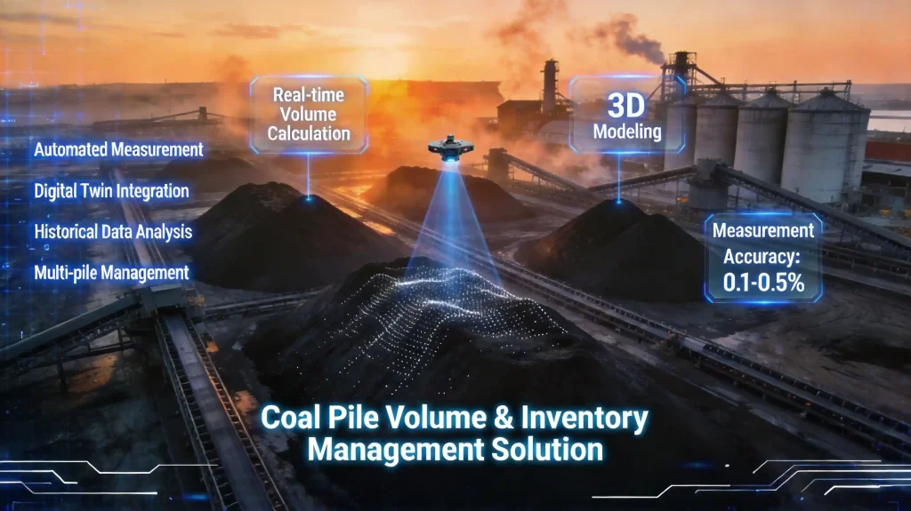
Inventory Management
Intelligent mine haulage